

Prescribed Burns on Tribal Land Near Myrtle Creek
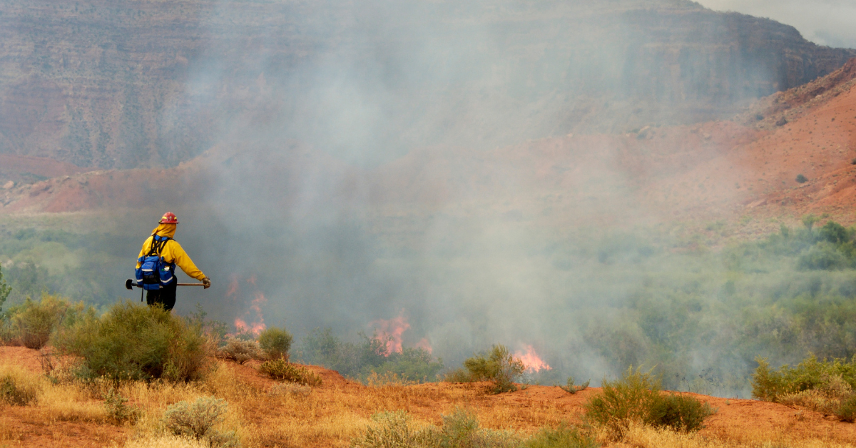
The Cow Creek Band of Umpqua Tribe of Indians will be conducting a prescribed burn on Tribal land located just north of Myrtle Creek.
The burn will occur on Monday (9/26) and Tuesday (9/27) in the vicinity of Dole Road, located north of Myrtle Creek and south of Roseburg on the east side of Interstate 5, as well as on the west side of the freeway near Highway 99 and the South Umpqua River.
Along with Cow Creek Umpqua Natural Resources staff, the burn will be conducted under the advisory of Douglas Forest Protective Agency. Burning is expected to begin around 10AM each day.
Because of the land’s proximity to Interstate 5, it is possible smoke will be visible from the freeway. Tribal leadership and DFPA want to assure the public that the burn is planned, and under control.
Weather in Roseburg and Douglas County brought some rain and cooler mornings to the area last week, however, drier conditions are on the way. According to forecasters with the Oregon Department of Forestry, winds will be light during this warming trend on Monday and Tuesday, but there could be a few light rain showers possible Tuesday night.
The Tribal lands where the burns will occur are known as the Dole Property and Lilja Property. The Dole Role property is 783 acres and the Lilja property is 252 acres. The Cow Creek Umpqua Tribe uses both properties for agriculture, livestock grazing, and hunting.


